
High Anxiety as Humberto Gathers Strength
Energy in the air is running high along much of the Southeast coastline, where residents and tourists are keeping a close watch on Hurricane Humberto. As of late September 25, 2025, the storm has quickly transitioned from a tropical storm to a hurricane over the southwestern Atlantic, its swirling bands feeding both the weather radar and public uncertainty. Crowd reactions have been a blend of anxious preparation and tense hope, with many recalling the chaos of past hurricane seasons.
Meteorologists, too, are glued to their screens, issuing urgent updates. Social media is pulsing with real-time spaghetti models, while TV news anchors walk viewers through possible scenarios, each more dramatic than the last. On the ground, people are boarding up windows, monitoring local alerts, and quietly hoping the models hold steady and keep the storm away from major population centers.
Forecast Uncertainty and Key Developments
As atmospheric scientists analyze ensemble model forecasts, they're seeing evidence that Humberto is rapidly organizing and could strengthen into a major hurricane—possibly Category 4—over the coming days. Winds have already topped 75 mph, pushing Humberto into hurricane status as of September 25.
Here are the latest verified developments and expert insights:
- Projected Path: Most major models forecast Humberto will track northward in the Atlantic, away from the core of the Southeast coast. However, some outlier models hint at a more westward direction, raising concerns for the Bahamas and coastal U.S. communities.
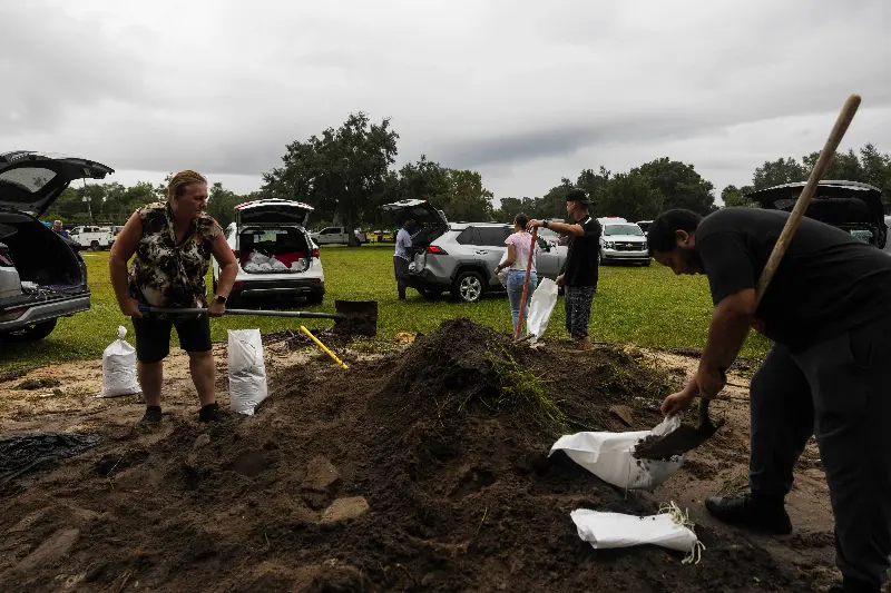
- Risk Areas: Meteorologists warn that the Bahamas, Caribbean, and the southeastern U.S.—especially Florida and the Carolinas—should remain vigilant. The atmospheric conditions are in flux, making projected impacts uncertain and urging coastal residents to prepare for rain, wind, and the possibility of stronger storms.
- Strengthening Likely: The National Hurricane Center and media like FOX Weather are reporting that Humberto is showing signs of significant intensification. A transition to a Category 4 hurricane by the weekend is now in the forecast, which would mean sustained winds upward of 130 mph.
- Fujiwhara Effect: Meteorologists are closely monitoring the possibility that Humberto could interact with another nearby tropical system, potentially causing unpredictable motion. This rare event—called the Fujiwhara effect—occurs when two storms spin around each other, further complicating all forecasts.
- Meteorologists' Caution: Roger Martin of the National Weather Service reminds everyone that tropical forecasting is inherently chaotic. "A run today appears significantly different from a run of the same model on a different day," he says, highlighting the emotional up-and-down both experts and coastal residents are experiencing.
Preparation and Key Takeaways
The potential escalation of Humberto to major hurricane status is a stark reminder of the unpredictable nature of the 2025 Atlantic hurricane season. The atmosphere is thick with anticipation, with many people stocking up on essentials, checking evacuation routes, and leaning into their communities for support.
- Stay Alert: Forecasters stress it’s still too early to dismiss risks to the U.S. Southeast, urging everyone to monitor updates as models become clearer.
- Prepare for the Worst: With Humberto likely to become an even stronger hurricane, residents along the likely path—especially Florida and the Carolinas—should prepare for heavy rain and potentially dangerous winds.
- Emotional Impact: The evolving scenario is stirring memories of past storms and keeping communities emotionally on edge, with many rallying behind local officials and meteorologists as daily updates roll in.
- Model Caution: Experts are unanimous: significant uncertainty remains and small shifts in atmospheric steering could radically change the outcome, making next week crucial for millions watching the Atlantic.
As Humberto gains power and its path sharpens, the coming days will test both scientific predictions and community resilience. The atmosphere is fraught with nervous energy, but generations of hurricane-season experience have locals bracing—preparing for the worst while hoping for the best.